Distance: 11 miles round trip
South Sister is the third highest peak in the state of
Oregon. Only Mt. Hood at 11,250’ and Mount Jefferson at 10,495’ are taller than
South Sister’s highest point of 10,358’. The trail is very well groomed and
doesn't require any bouldering or rock climbing skills. However, that doesn't
mean the trail is easy… Long, insanely steep stretches with loose footing, make
this trail one of the most taxing day hikes in Oregon.
To find the trailhead from Bend, travel west on Hwy 372 towards Mt. Bachelor.
The trailhead is located at Devils Lake, just ten minutes past Bachelor. Bring
your NW forest pass or pay the $5 day fee, strap on some gaiters, and lube up
with sun block. If you have a light weight water filter it could come in handy.
Depending on your pace, it could take anywhere from six to ten hours to
complete this hike... That’s a lot of water weight to carry. There are a couple very
good water sources you can take advantage of.
The trail log below details the 5,000 feet of elevation gain and 5.5 mile trek to the summit in five distinct phases: The Forest, Flat
Ground!, First Incline, Second Incline, and Summit.
 |
| South Sister |
Phase
I - The Forest
This first 1.5 mile stretch quickly welcomes
hikers with a “modest” 1,250 feet of elevation gain. That may not sound modest,
but once (if) you reach Phases III and IV, you’ll yearn for the well groomed,
solid footing of The Forest.
 |
| Mossy Trees |
 |
| Wooded Switch Backs |
There is not much to see in this first stretch. This entire
portion is blanketed with mossy trees and undergrowth.
Phase II – Flat Ground!
You’ve made it to flat ground! Kind Of. This
section of the trail runs 1.7 miles long and gains 500 feet. The elevation gain
is back loaded, so the first 1.5 miles are fairly flat. Enjoy it while it lasts.
 |
| South Sister in the Background |
 |
| Trail Sign to Moraine Lake |
 |
| Moraine Lake and Broken Top |
The second phase begins with your first clear view of South
Sister. You’ll also have an option to take a 0.8 mile detour to
Moraine Lake. Moraine Lake is a popular destination for
backpackers and can be crowded with tents in the summer months. Well worth the side trip if you’re up for it.
 |
| Broken Top in the Distance |
 |
| Mt. Bachelor to the South |
Continuing
forward, you’ll catch your first views of Broken Top to the west and Mt.
Bachelor to the South.
When you start to gain elevation and the trail transforms
from compacted dirt to loose gravel, you’ll begin the transition to Phase III.
Phase III – First Incline
1,600 feet of elevation gain in only 1.2 miles!
Not only that, but you’ll be stomping through loose gravel. The popular phrase
with hikers is, “two steps forward, one step back.” Take your time. Trekking
poles are a good idea.
 |
| Facing South - Mt. Bachelor and Moraine Lake |
The
south facing view extends far and beyond as you continue to climb: Devils Lake,
Moraine Lake, Mt. Bachelor, and Broken Top are all visible behind you.
 |
| South Facing View |
 |
| Lewis Glacier |
It’s commonly known that South Sister has a false mountain. But
I think it has two. After busting ass to
finish Phase III, it feels like you've
reached the summit, but on the other side
of the saddle is Lewis Glacier, followed by another steep hike up loose gravel.
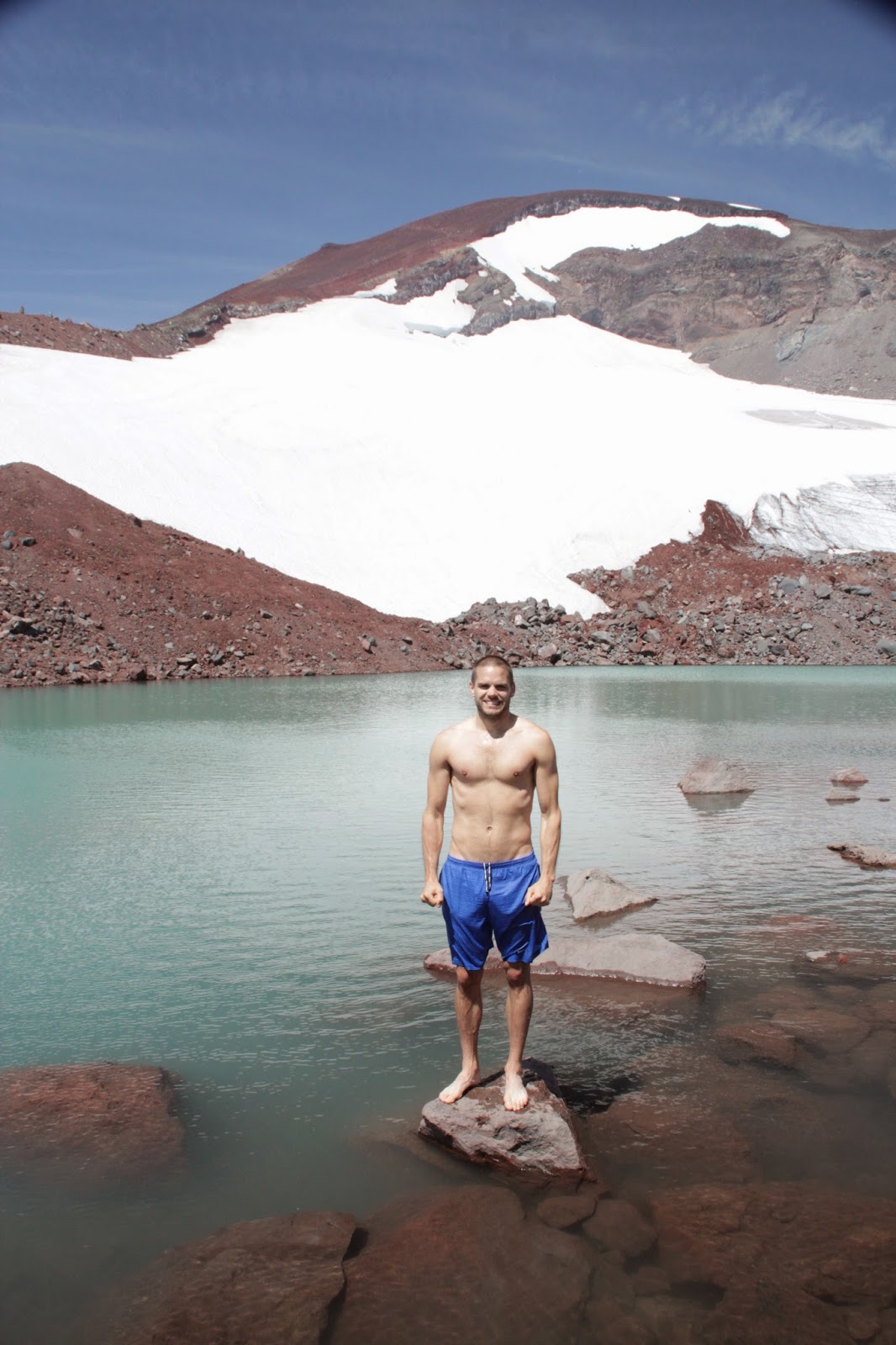
Phase IV – Second Incline
Lewis Glacier is a great spot to relax and gain strength before tackling the
final leg. The view is incredible! You
can also take a dip in the lake and top off your water bottle.
When
you’re ready, the final stretch spans 1.1 miles and gains 1,508 feet of elevation.
Very similar to the last grueling segment...
 |
| Lewis Glacier Saddle |
 |
| Red Dust Climb |
 |
| Facing South from the top of Phase IV |
Take your time. The last mile is steeper than anything you've encountered so far. Switch backs will take you up red cinder dust – two steps
up, one step back.
Phase V – The Summit
When the red dust ceases, you've reached the
summit! The false summit… no worries, the true summit lies just around the
ridge, past the snow field.
 |
| Inside the Wind Shelter |
The
summit can be very windy – long sleeves are a must. If you get too cold, there’s
a brilliantly made wind shelter along the rim.
 |
| South View - Teardrop and Mt. Bachelor |
Rest up and enjoy the summit!!
The last two miles up can be just as tough going down. Allow momentum to help you skate down the scree. Trekking poles and gaiters are especially helpful. If you didn't already take a dip in Lewis Glacier Pool, now's your last chance!


No comments:
Post a Comment