Saturday, March 17, 2018

Reducing Weight and Improving Trail Nutrition


Reducing Weight and Improving Trail Nutrition
We all know you’ve cut that base weight down to shoe strings and still looking to optimize pack weight! Why not adjust your menu? You don’t have to be “stupid light” to cut more weight.  Below is my strategy for saving weight through trail nutrition. Ill show you how to save over a pound a day in food weight without sacrificing taste and nutrition. A few things to consider first:


Friday, October 24, 2014

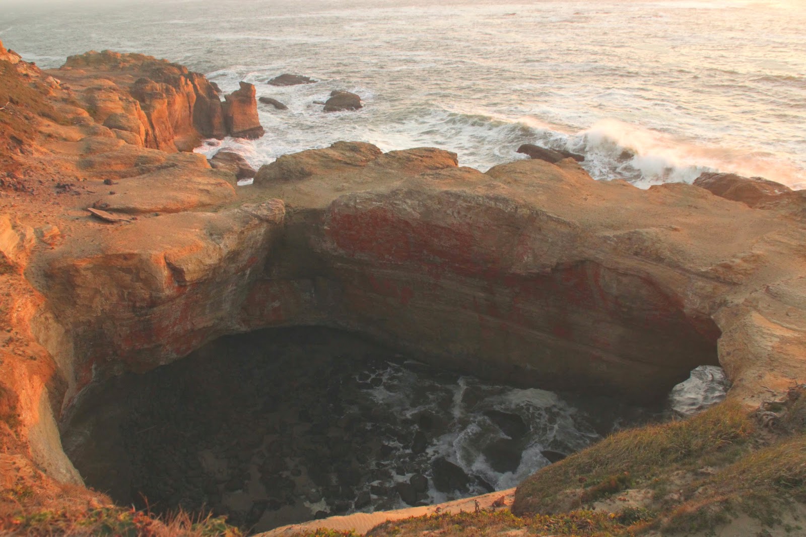
Devil's Punch Bowl

Distance: <1 mile
I must begin by mentioning that this "hike" doesn't involve a trail. Yes, there may be a distinguished path leading from the parking area, but that path leads to a beach. Once there, you may proceed as you see fit... Or, you may drive straight to the overlooking Devil's Punch Bowl viewpoint, which requires zero hiking.

To find the beach, head south on Hwy 101 from Lincoln City for about 16 miles before taking a right at Otter Crest Loop Road. The road is between the cities of Depo Bay and Newport. From here, take the split left to Devil's Punch Bowl viewpoint. Just follow signs from here. Beach access can be found by taking a right on Sea Crest Dr and following the road to it's end.
Devil's Punch Bowl from Viewpoint

Wednesday, October 22, 2014

Rattlesnake Ledge

Distance: 4 miles round trip
Rattlesnake Ledge is a very popular destination from the Seattle metropolitan area. Located 34 miles from downtown, it's just far enough to escape the city, but not too far. Just head East on I-90 out of Seattle until you reach the North Bend/Snoqualmie Pass area.  Take exit 32 and follow Cedar Creek Rd south until you reach the parking lot. It's not your typical trailhead parking lot - this one accommodates a high volume of visitors.
Rattlesnake Ledge

Wednesday, September 3, 2014

Jefferson Park

Distance: 11 miles round trip
Jefferson Park is an alpine wonderland for the backpacking enthusiast. There are several lakes, ponds, and meadows scattered around the base of Mt. Jefferson. Consider staying multiple nights to explore, take pictures, fish for trout, or just relax in the beautiful scenery. Seriously an impressive area.

To find the trailhead from Salem, start by taking Hwy 22 east towards Detroit Lake. As soon as you reach the small town of Detroit (~50 miles) take a left onto Hwy 46 and head east. Remain on Hwy 46 until the road takes you North (~15 miles). At this point, take a right on NF-4220. After seven miles of this narrow, rocky road, you will reach the trailhead, AKA the Pacific Crest Trail (PCT). BEWARE: this road is very rocky, consider driving an AWD vehicle with high ground clearance. Also note that NF-4220 and parts of Hwy 46 are closed between Nov-June. 
Mt. Jefferson

Tuesday, August 19, 2014

Moraine Lake

Distance: 4.6 miles out and back
Moraine Lake is a solid backpacking destination only 25 minutes outside of Bend, OR. Just travel  west on Hwy 372 towards Mt. Bachelor. The trailhead is located at Devils Lake, just ten minutes past Bachelor. Bring your NW forest pass or pay the $5 day fee. Because Moraine Lake shares its path with South Sister, the trailhead can be quite crowded in the summer. Hit the road early.
South Sister - Atop the Forest