Distance: 11 miles round trip
Jefferson Park is an alpine wonderland for the backpacking enthusiast. There are several lakes, ponds, and meadows scattered around the base of Mt. Jefferson. Consider staying multiple nights to explore, take pictures, fish for trout, or just relax in the beautiful scenery. Seriously an impressive area.
To find the trailhead from Salem, start by taking Hwy 22 east towards Detroit Lake. As soon as you reach the small town of Detroit (~50 miles) take a left onto Hwy 46 and head east. Remain on Hwy 46 until the road takes you North (~15 miles). At this point, take a right on NF-4220. After seven miles of this narrow, rocky road, you will reach the trailhead, AKA the Pacific Crest Trail (PCT). BEWARE: this road is very rocky, consider driving an AWD vehicle with high ground clearance. Also note that NF-4220 and parts of Hwy 46 are closed between Nov-June.
 |
| Mt. Jefferson |
The red dirt parking area is obvious enough and the trailhead is marked with several signs indicating the PCT. The entire 5.5 mile hike to Jefferson Park is along the PCT. If traveling in August, you are bound to run into some PCT thru-hikers, plenty of which began their trek at the Mexican border.
 |
| Dead Forest |
 |
| First View of Mt. Jefferson |
The first couple miles lead you through the forest alternating between sections of live and burned trees. At about 1.5 miles you'll catch your first glimpse of Mt. Jefferson through the trees. This glimpse is very brief, but foreshadows its dominance of the landscape.
 |
| Pyramid Butte, Olallie Butte, & Mt. Hood |
The tree line begins to thin after a couple miles on the trail. Look back to find Mt. Hood! The terrain opens up, featuring alpine meadows full of wild flowers.
 |
| View of Mt. Hood near the top of Park Ridge |
At this point in the trek, you will begin a steady ascension to Park Ridge. The terrain will transition from colorful meadows and trees to a barren, rocky, mountain side. However, there's no lack of scenery! You'll have the entire Mt. Hood National Forest to your back, with nothing to obstruct the view.
 |
| Facing North from Park Ridge: Mt Hood, Mt Adams, Mt. St. Helens |
 |
| Facing South from Park Ridge: Mt. Jefferson, Russell Lake |
|
|
After 4 miles and 1,500' of elevation gain you'll reach Park Ridge - the 300 degree panorama is the undisputed climax of this hike. Mt. Hood National Forest (and beyond) to the north and Jefferson Park to the south. It can be cold and windy at 7,000'! Plan accordingly. From Park Ridge, you'll travel 1.5 miles, with 1,100' of elevation loss in route to your final destination.
 |
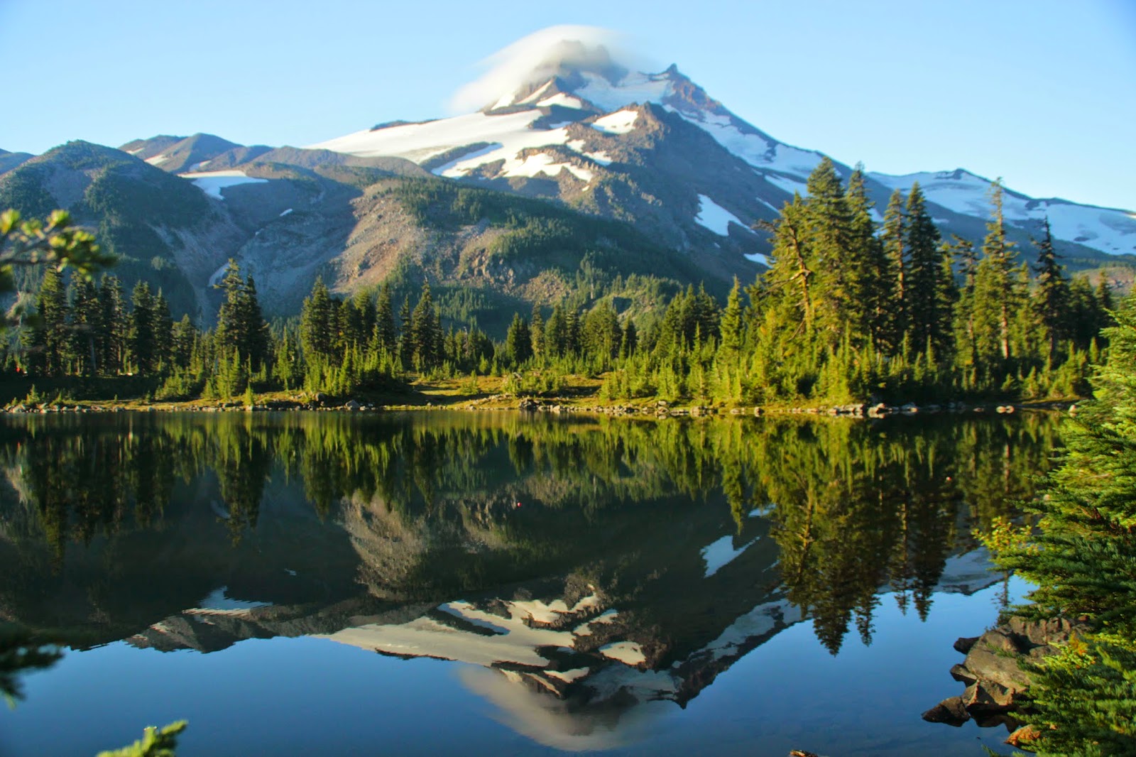
| Russell Lake |
While descending Park Ridge into Jefferson Park, you'll have a constant view of Mt. Jefferson for the remainder of your stay. The giant mound of earth is impossible to avoid at this point. I'm not complaining... We decided to camp at Russell Lake. However, there's a plethora of marked campsites spanning several miles, including prime camping at Bays Lake and Scout Lake.
You've made it! Enjoy any way you see fit!
Regardless of the forecast, temperatures can be very cold in the shade. Bring warm layers, especially if you plan to take a dip in one of the many lakes.


No comments:
Post a Comment